

Clouds fill the skies above us and are part of our every day lives but often go unnoticed. Clouds come in many shapes and sizes, but some formations are so rare that they almost seem otherworldly. These unusual clouds typically require very specific atmospheric conditions to form and are a spectacle for those lucky enough to witness them reminding us of the intricacies of nature’s beauty and the complex interactions of the atmosphere. Along with running Cool Things Collection, I’m also a full time professional wedding photographer in Cornwall – South West England, and i’m always looking for dramatic skies/clouds for the backdrop to my images but haven’t yet witnessed a rare cloud formation. This is a list of the 10 rarest cloud formations in no particular order that for those lucky enough to see them, were caught on camera.
Nacreous Clouds (mother of pearl clouds)
These rare clouds, sometimes called mother-of-pearl clouds are 15 – 25km (9 -16 miles) high in the stratosphere and well above tropospheric clouds. They have iridescent colours but are higher and much rarer than ordinary iridescent clouds. They are seen mostly but not exclusively in polar regions and in winter at high latitudes, Scandinavia, Alaska, Northern Canada. Lower level iridescent clouds can be seen anywhere. Nacreous clouds shine brightly in high altitude sunlight up to two hours after ground level sunset or before dawn. Their unbelievably bright iridescent colours and slow movement relative to any lower clouds make them an unmistakable and unforgettable sigh

Mammatus Clouds


Altocumulus Castelanus (jellyfish clouds)
Noctilucent Clouds
One of the rarest cloud types, noctilucent clouds, appear high in the mesosphere, about 50 miles above the Earth’s surface. These clouds are made of ice crystals and are visible only during twilight, when the sun is below the horizon but still illuminates them from below. They have a ghostly, blue glow, and are most commonly seen in polar regions during the summer months. Their formation is influenced by a delicate balance of moisture, temperature, and high-altitude winds.

Mushroom Clouds


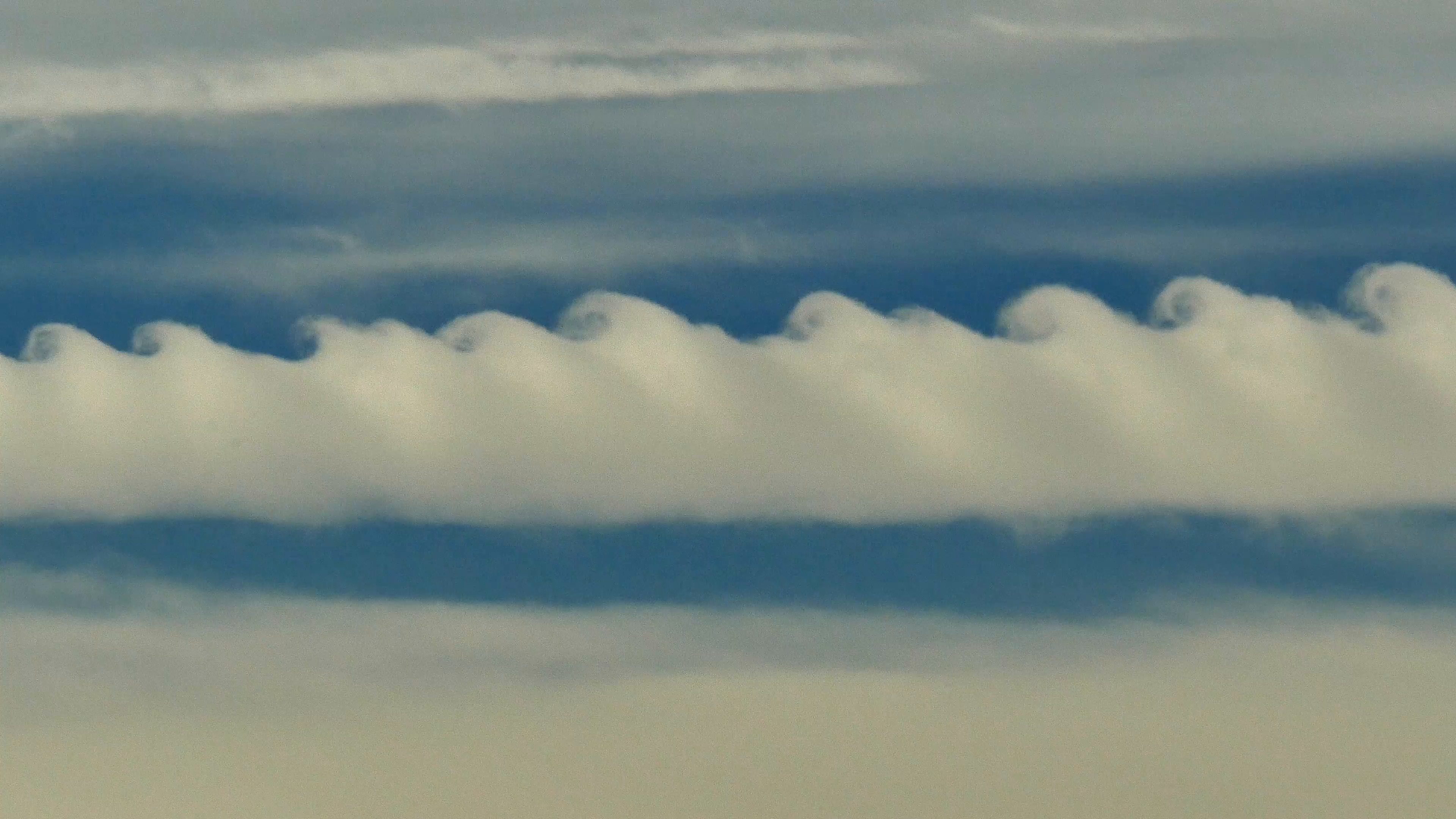
Cirrus Kelvin-Helmholtz
7. Lenticular Clouds
Lenticular Clouds are lens-shaped clouds that form over mountain ranges due to air currents being forced up and over the peaks. These clouds can appear as stationary saucers or pancakes, and are often mistaken for UFOs due to their distinctive shape. They are more commonly found in areas with strong winds and topography that disrupts airflow. Technically known as altocumulus standing lenticularis are stationary lens-shaped clouds that form at high altitudes, normally aligned at right-angles to the wind direction. Where stable moist air flows over a mountain or a range of mountains, a series of large-scale standing waves may form on the downwind side. Lenticular clouds sometimes form at the crests of these waves. Under certain conditions, long strings of lenticular clouds can form, creating a formation known as a wave cloud. Lenticular clouds are popular with UFO believers because they often look like flying saucers. The lens-shaped clouds form at high altitude and are usually formed when moist air passes over a mountain range and is heated adiabatically (that is, without any transference of heat energy) as it descends. The cloud pattern depends upon the wind speed and the shape of the mountains. A constant wind may produce clouds which are stable and remain virtually stationary in the sky for long periods.


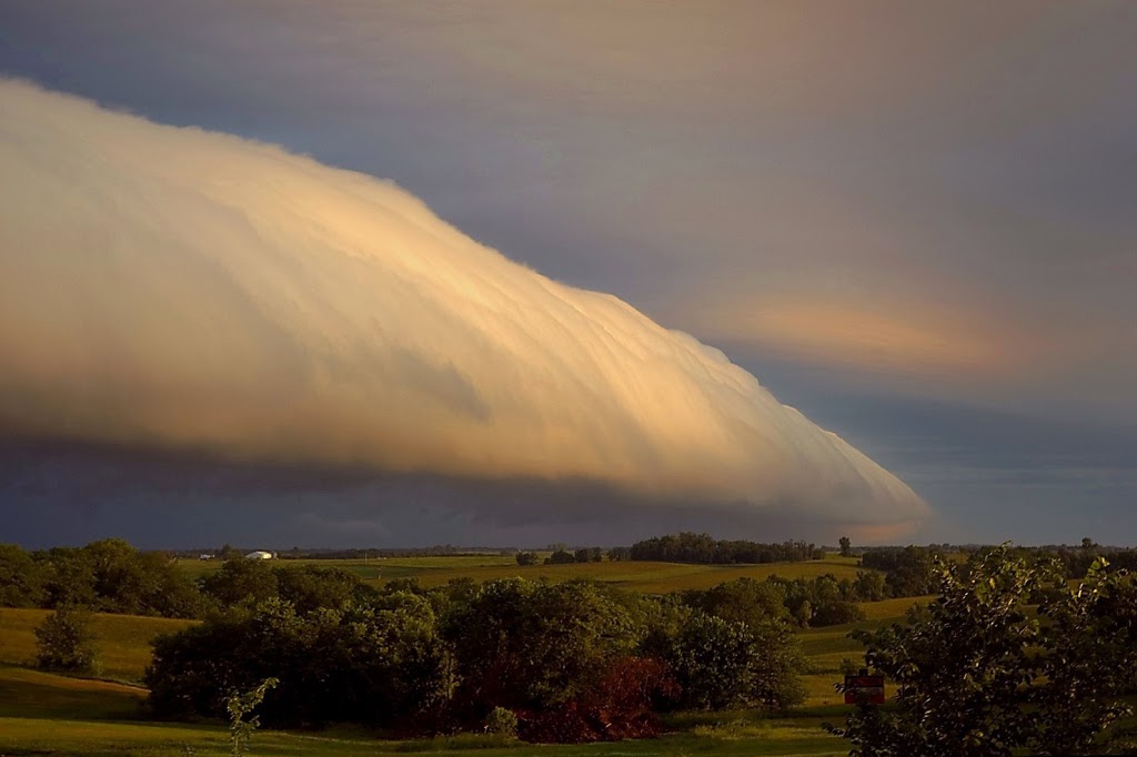
8. Roll Clouds & Morning Glory Clouds
A roll cloud is a low, horizontal tube-shaped arcus cloud associated with a thunderstorm gust front, or sometimes a cold front. Roll clouds can also be a sign of possible microburst activity. Cool air sinking air from a storm cloud’s downdraft spreads out across the surface with the leading edge called a gust front. This outflow undercuts warm air being drawn into the storm’s updraft. As the cool air lifts the warm moist air water condenses creating cloud, which often rolls with the different winds above and below (wind shear). Roll clouds are basically shelf clouds without attachment to a thunderstorm.
Morning Glory cloud is a rare meteorological phenomenon occasionally observed in different locations around the world. The southern part of Northern Australia’s Gulf of Carpentaria is the only known location where it can be predicted and observed on a more or less regular basis due to the configuration of land and sea in the area. The settlement of Burketown attracts glider pilots intent on riding this phenomenon.


Shelf Clouds

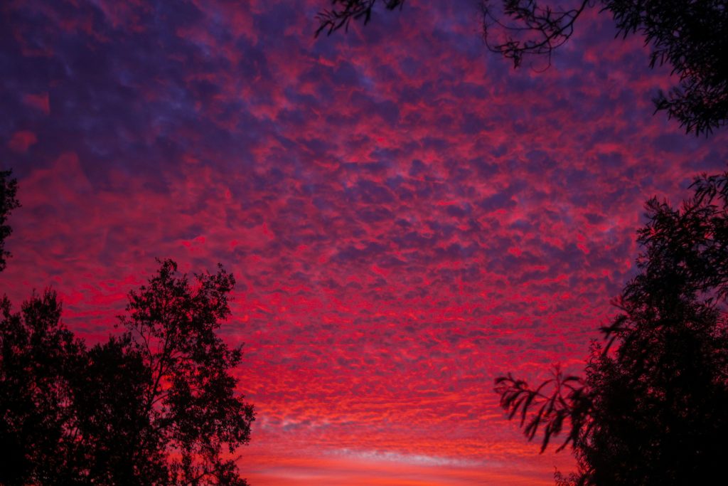
Undulatus Asperatus Clouds